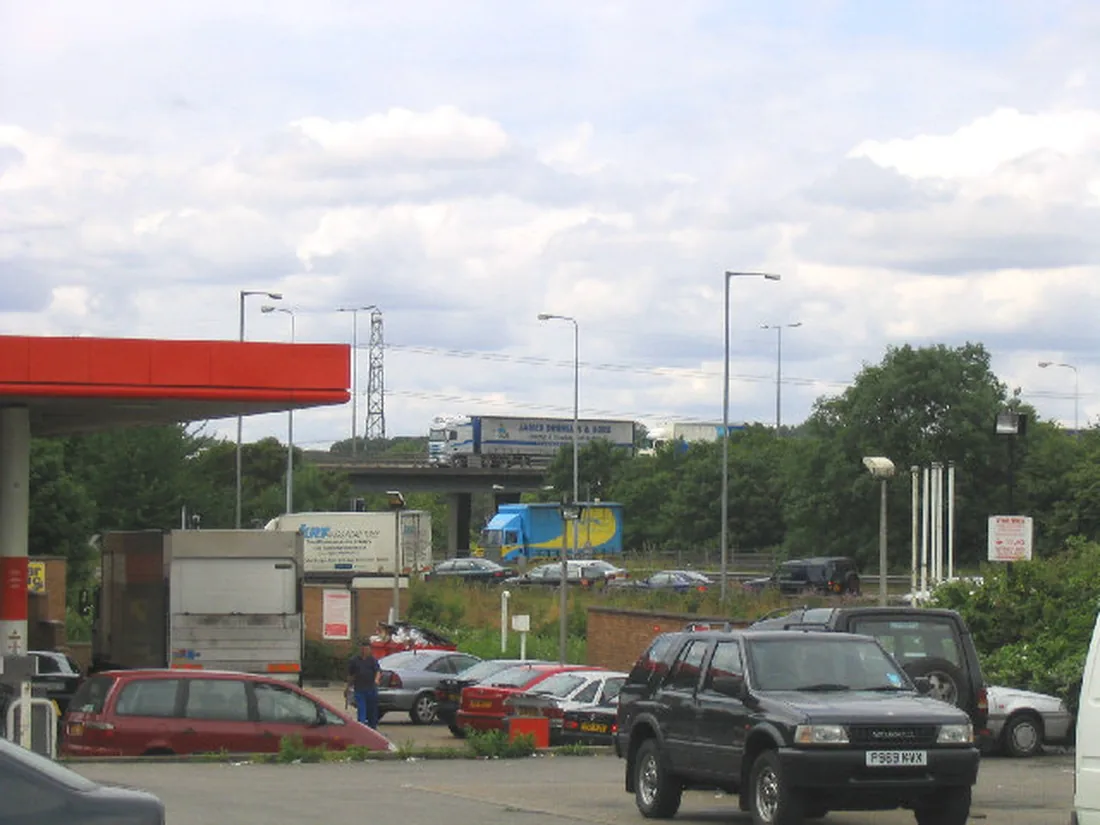

Coptfold Road, the approach to the town multi-storey, shuts for two days from 8 October. The M25 clockwise closes overnight J27 to J28 on 7 and 8 October.
The roadworks to plan around this week are in town and on the motorway into it:
- Coptfold Road, Brentwood, the approach to the multi-storey car park, shuts from Thursday 8 October for two days
- Beredens Lane, Great Warley shuts from Monday 5 October for three days, and the notice says there is no alternative route
- M25 clockwise, junction 27 to junction 28, carriageway, link road and slip roads, 22:00 to 05:30 on Wednesday 7 and Thursday 8 October, for resurfacing
The M25 anticlockwise closures between junctions 29 and 28 that ran through late September are not in the current National Highways report. Old Road at Navestock reaches the last scheduled day of its Affinity Water closure on Monday 5 October.
Updated 3 October. Essex County Council published a new batch of Brentwood orders on 30 September. It adds four closures from 26 October: Church Lane in Little Warley, Fryerning Lane in Ingatestone, Hall Lane in Shenfield and Russell Close in Brentwood. Russell Close is shut for nine days. The National Highways report issued on 2 October replaces the junction 29 to 28 nights with the junction 27 to 28 closure above.
This page tracks Brentwood roadworks against the statutory traffic orders and the National Highways closure report. It was last updated on 3 October 2026.
Closed now and this week
Three Essex County Council closures fall in the next seven days. All three are made orders, meaning the council has taken the decision.
- Old Road, Navestock. From Tuesday 29 September for 7 days, so the last scheduled day is Monday 5 October. About 170 metres, starting 225 metres south east of Bounce Hill, for an Affinity Water connection. The diversion runs via Old Road, Horseman Side, Tan House Lane, Sabines Road and Bounce Hill.
- Beredens Lane, Great Warley. From Monday 5 October for 3 days, about 465 metres from the Warley Street junction, for Openreach duct clearance. No alternative route is available.
- Coptfold Road, Brentwood. From Thursday 8 October for 2 days, about 15 metres between the Library Hill and New Road junctions, for Openreach pole replacement. The signed route round runs via Crown Street, Queens Road and Alfred Road, with no access into New Road.
Coptfold Road is the approach to the 523-space multi-storey, the cheapest car park in town for a short stay. William Hunter Way and Chatham Way are the nearest alternatives; tariffs are in the parking table further down this page.
Now reopened, on the notices’ own dates: Childerditch Lane in Little Warley reached the last day of its two-day O2 closure on 2 October. Notices always allow for dates to slip, and the live position is shown on one.network.
Sources: Essex County Council notices published 15 September, 9 September and 23 September 2026.
New this week: four closures from 26 October
Essex County Council’s notice of 30 September carries four new Brentwood closures. All four are intentions, and their orders come into effect on 7 October.
- Church Lane, Little Warley. From Monday 26 October for 3 days, about 65 metres east from the Warley Street junction, for Openreach duct clearing. No alternative route is available.
- Fryerning Lane, Ingatestone. From Monday 26 October for 3 days, about 150 metres starting 325 metres south east of the Blackmore Road junction, for Openreach duct laying. The diversion runs via Blackmore Road, Bag Lane, Trueloves Lane and the B1002.
- Hall Lane, Shenfield. From Monday 26 October for 2 days, about 45 metres starting 60 metres north west of the Lewis Close junction, for Openreach pole replacement. The diversion runs via the A1023, the A128 and Doddinghurst Road.
- Russell Close, Brentwood. From Tuesday 27 October for 9 days, about 50 metres from the St Kildas Road junction, for a UK Power Networks connection. No alternative route is available, so the last scheduled day is Wednesday 4 November.
The same notice re-advertises Ashwells Road, Hutton Village, Kingsley Road and Mill Green Road as made orders, on the dates already listed below (Essex County Council, 30 September 2026).
Alexander Lane and Essex Way, advertised 23 September
- Alexander Lane, Shenfield. From Saturday 24 October for 9 days, about 170 metres from a point 35 metres north of the Shenfield Gardens junction. The work is bellmouth reconstruction by GTM Ltd. The diversion runs via Alexander Lane, Rayleigh Road, Hutton Road and Chelmsford Road, with access only into Alexander Lane and Oliver Road.
- Essex Way, Great Warley. From Monday 19 October for 3 days, the whole length between The Drive and Eagle Way, about 400 metres, for carriageway patching by Essex County Council. The diversion runs via Eagle Way and The Drive.
Both orders came into effect on 30 September (Essex County Council, 23 September 2026).
Bridleway 183 near Codham Hall moves on 13 October
The same notice confirms a diversion of Bridleway 183 Brentwood, south west of Codham Hall and north of the A127 Southend Arterial Road. The path currently runs through a storage compound. The new route goes round the outside of the compound fencing and along the eastern edge of Codham Hall Wood.
- the alternative route opens on 13 October 2026
- the old route through the compound is stopped up from 20 October 2026
The order map can be requested from publicpathorders@essexhighways.org.
HGVs allowed through the High Street during Ongar Road closures
This is the item in the late-September notices that could change Brentwood town centre. A separate Essex County Council order for Epping Forest district, the (Various Roads, District of Epping Forest) Order (No.13) 2026, lifts the 7.5 tonne weight limit on Brentwood High Street. It covers the length between the Ingrave Road junction and the Kings Road junction.
The limit is lifted only while closures elsewhere under the same order are in place. The longest is on the A113 west of Ongar:
- London Road and Romford Road, Stapleford Rivers, and Stanford Rivers Road, Ongar, from Shonks Mill Road to Brentwood Road, about 4,865 metres, with the signed diversion via the A128, A1023, A12, A1112 and A113
- Oak Hill Road and Stapleford Road, Stapleford Abbotts, about 4,130 metres from Passingford Bridge roundabout
The A1023 is Brentwood High Street, so the diversion for the Ongar road closure comes through the town centre. That is why the weight limit is being suspended.
Like the framework orders below, it names no dates. The works “will take place within an 18-month period from 1st October 2026”, with exact dates on one.network and residents told by letter or leaflet. It was advertised on 24 September as an intention, with the order due to come into effect on 1 October 2026 (Essex County Council, 24 September 2026).
Confirmed closures, next five weeks
These orders have been made, or were advertised as intentions whose orders are now in effect. Dates can still slip. Every notice says the scheduled dates may vary and that the live position is shown on one.network.
| Road | From | Length of closure | Reason |
|---|---|---|---|
| Old Road, Navestock | Tue 29 Sep | 7 days | Affinity Water connection |
| Beredens Lane, Great Warley | Mon 5 Oct | 3 days | Openreach duct clearance |
| Coptfold Road, Brentwood | Thu 8 Oct | 2 days | Openreach pole replacement |
| Hutton Village, Hutton | Mon 12 Oct | 2 days | Openreach pole replacement |
| Ashwells Road, Pilgrims Hatch | Mon 12 Oct | 1 day | Anglian Water sewer cleaning |
| Kingsley Road, Hutton | Fri 16 Oct | 11 days | Footway repair |
| Mill Green Road, Fryerning | Fri 16 Oct | 5 days | Openreach duct clearance |
| Essex Way, Great Warley | Mon 19 Oct | 3 days | Carriageway patching |
| Alexander Lane, Shenfield | Sat 24 Oct | 9 days | Bellmouth reconstruction |
| Church Lane, Little Warley | Mon 26 Oct | 3 days | Openreach duct clearing |
| Fryerning Lane, Ingatestone | Mon 26 Oct | 3 days | Openreach duct laying |
| Hall Lane, Shenfield | Mon 26 Oct | 2 days | Openreach pole replacement |
| Russell Close, Brentwood | Tue 27 Oct | 9 days | UK Power Networks connection |
Beyond this week, three are worth planning around:
- Kingsley Road, Hutton is the longest job in the borough at 11 days, so its last scheduled day is Monday 26 October. It covers the whole length between the Tennyson Road and Hall Green Lane junctions, about 105 metres, and the way round is via Tennyson Road, Shelley Road and Hall Green Lane.
- Mill Green Road, Fryerning shuts for about 240 metres between Mapletree Lane and Hardings Lane, with a long diversion via Beggar Hill, Blackmore Road, Ingatestone Road and Chelmsford Road.
- Russell Close, Brentwood and Church Lane, Little Warley both have no alternative route, so residents at the closed end need to plan for those days.
The others: Hutton Village is about 45 metres near the Hall Green Lane junction, diverted via Church Lane and Rayleigh Road; Ashwells Road is about 50 metres from the Well Lane junction, diverted via Crow Green Road and Ongar Road.
Sources: Essex County Council notices published 9 September, 15 September, 23 September and 30 September 2026.
Kelvedon Hatch: a framework order with no dates at all
The (Various Roads, Borough of Brentwood) (SW1) Order 2026 came into effect on 16 September 2026. It is a framework: it takes the power to close two lengths of road in phases at any point in the following 18 months, for micro ducting works by Gigaclear. Between them the two lengths come to about 1,075 metres:
- Church Road, Kelvedon Hatch, from the Ongar Road junction to the Beacon Hill Road junction, about 765 metres, with the diversion via Beacon Hill Road, Howard Lodge Road, Dudbrook Road, Crown Road and Ongar Road
- Kelvedon Hall Lane and Kelvedon Hall Road, Kelvedon Hatch, from the Beacon Hill Road junction for about 310 metres, with the diversion via Kelvedon Hall Lane, Ongar Road and Church Road
The order sets no schedule. Essex County Council says the roads will be closed to facilitate each phase and then reopened, with exact dates published on one.network, and that residents will be told the dates of each phase by letter or leaflet drop and by advance warning signs. Emergency access is maintained throughout. Enquiries go to the contact centre on 0345 603 7631 (Essex County Council, 9 September 2026).
What it means for you: if you live on or drive through Church Road or Kelvedon Hall Lane, the letter through the door is the only advance notice you will get. That is now true of four separate framework orders in this borough, covering the A128, Billericay Road at Herongate, the Brook Street access road and Kelvedon Hatch.
Herongate: 2,350 metres of Billericay Road, still no dates
The most significant order in Brentwood right now names no closure dates, which is exactly why it is worth reading before it bites. The Various Roads, Borough of Brentwood (No.10) Order 2026 came into effect on 9 September 2026 and can stay in force for 18 months. It covers one stretch:
- Billericay Road, Herongate, from its junction with Brentwood Road to its junction with Blind Lane, a distance of about 2,350 metres
The order is a permission, not a closure. The council’s wording is that the road will be closed “to facilitate each phase of works and then re-opened to the public”, with the exact dates published on one.network. A temporary no waiting, no loading and no stopping restriction applies on both sides of the carriageway while each phase runs.
The signed diversion is long: the A128, Running Waters, Pondfield Lane, Hanging Hill Lane, the A129 and Tye Common Road. Emergency services keep access throughout, and the council says residents will be told the dates of each phase by letter or leaflet, with advance warning signs on the road. Enquiries go to the contact centre on 0345 603 7631 (Essex County Council, 2 September 2026).
Brook Street: the access road, not the A1023
A second framework order, the No.9 Order 2026, also came into effect on 9 September and also runs for up to 18 months. It covers two lengths of Brook Street (Access Road) in Brentwood, the service road, not the A1023 itself:
- from about 125 metres south west of the Vicarage Close junction, for about 70 metres to its end, with no diversion available
- from about 40 metres south west of the Vicarage Close junction, for about 80 metres south west, with the diversion via Brook Street
The first of those two is the one to note. Where a closure has no alternative route, the council is saying there is no way round: the length runs to a dead end (Essex County Council, 2 September 2026).
The A128 order: five weeks in, still no dates published
The framework order covering nearly eight kilometres of the A128 came into effect on 26 August 2026 and can stay in force for 18 months. Five weeks on, no phase dates have appeared in any Essex County Council notice.
It covers two long stretches, and between them they are the main north and south routes out of the borough:
- A128 Brentwood Road, Herongate and Ingrave, from Running Waters to the Halfway House roundabout, about 4,335 metres
- A128 Ongar Road, Kelvedon Hatch, from the Epping boundary to the Blackmore Road junction, about 3,500 metres
As with Billericay Road, the roads are to be closed to facilitate each phase and then reopened, with exact dates on one.network and residents told by letter or leaflet. The advertised diversions are long. Herongate and Ingrave traffic is signed via the A127, A12, A1023 and A128, or the A127, A176, A129, A1023 and A128. Kelvedon Hatch traffic is signed via the A127, A1245, A130, A1114 and A414, or via the A1023, A12 and A414 (Essex County Council, 2 September 2026).
The M25 and A12 this week
The National Highways closure report issued on 2 October covers the nights to Thursday 8 October. The late-September closures between junctions 29 and 28 are not in it. The closures nearest Brentwood are on the stretch from Epping:
- M25 clockwise, junction 27 to junction 28, carriageway, link road, exit and entry slip roads, 22:00 to 05:30 on Wednesday 7 and Thursday 8 October, for resurfacing. The diversion is signed on the local authority and National Highways network.
- M11 southbound, junction 6 to the M25 at junction 27, the link road onto the M25 in both directions, 22:00 to 05:30 on Monday 5 and Tuesday 6 October, for resurfacing.
The Dartford Crossing has tunnel closures most nights. The northbound West Tunnel and the A282 junction 1A entry slip are listed 21:00 to 05:30 on Monday 5 to Thursday 8 October. The East Tunnel shuts from 21:00 on Saturday 3 October to 09:00 on Sunday, when there is no access over the Crossing for vehicles over 4.8 metres high. Southbound, the A282 between junctions 1A and 2 shuts 22:00 to 05:30 on Wednesday 7 October for emergency safety fence repairs. The Crossing is about 13 miles south of Brentwood.
On the A12 there is nothing between Brentwood and Chelmsford. The nightly closures are at the Colchester end:
- A12 northbound, junction 19 Boreham to junction 25 Marks Tey, 21:00 to 05:00 on every weeknight in the report, for carriageway reconstruction
- A12 southbound, junction 28 to junction 27, 21:00 to 05:00 on Tuesday 6, Wednesday 7 and Thursday 8 October
Source: National Highways road closure report, 7 day report for 2 to 8 October 2026, downloaded 3 October.
Trains
Transport for London’s status feed for the Elizabeth line, read on 30 September, lists no disruption on the Shenfield branch for the next fortnight. The only planned closure it carries is at the other end of the line, between West Drayton and Slough early on Sunday 11 October (Transport for London line status).
Greater Anglia’s alterations calendar, rechecked on 3 October, has nothing that stops a train at Brentwood or Shenfield in October. What it does list are slower journeys on the main line between Liverpool Street and Shenfield, where mainline and Southend Victoria trains share the remaining open lines with the Elizabeth line:
- Tuesday 6 October and Tuesday 13 October, from 23:05 until the end of service, journeys up to 10 minutes longer
- Sunday 11 October and Sunday 18 October, until 09:45 and from 23:05, journeys up to 15 minutes longer, and trains leave Liverpool Street up to 15 minutes earlier than normal
Check the time you leave London on those two Sundays (Greater Anglia service alterations).
Fares and journey times from each station are in our Brentwood to London trains page.
M25 junction 28: the scheme is essentially done
The junction where the M25 meets the A12 at Brook Street was a building site from 2022. The scheme, costing between £140m and £170m, was designed around a junction already carrying up to 7,500 vehicles in a peak hour, with National Highways projecting a 30% traffic increase by 2037.
The headline piece is finished. A new two-lane loop road, taking traffic from the M25 anticlockwise onto the A12 eastbound towards Brentwood, opened in October 2025. Two other pieces opened earlier: a longer entry slip onto the M25 anticlockwise from the Brook Street roundabout in January 2025, and an 800 metre off-slip from the A12 eastbound down to the Brook Street roundabout in March 2025. Four new bridges were built along the way, including Maylands Bridge and Alderwood Bridge, and more than 21,000 trees and shrubs have been planted (National Highways, M25 junction 28 improvements).
What is left is finishing work on the new layout, plus routine structural inspections, drainage surveys and safety barrier replacement. The scheme page, last updated on 2 March 2026, says that work is done under short overnight closures of the M25 anticlockwise entry slip at junction 28, 22:00 to 05:00, with traffic signed round via junction 29. The September closures went further than that: the report took out the anticlockwise carriageway between junctions 29 and 28 along with both slip roads on seven nights, for resurfacing rather than inspection.
The A1023 walking and cycling scheme
As a condition of the consent for the junction 28 works, National Highways has to provide a walking and cycling route from Brentwood through the junction and into Havering. Essex County Council is developing the Brentwood end on its behalf: a one mile shared-use path along the southern side of the A1023 Brook Street and London Road, between the Brook Street roundabout and Kavanaghs Road, with new signalised crossings at key points. The council consulted residents and businesses on the proposals in October 2024 (Essex Highways).
Separate schemes for the section through the junction itself and onward into Havering are being delivered by National Highways and the London Borough of Havering.
The A12 widening: consented, not started
The A12 north of Brentwood is the other pressure point, and the widening scheme that would ease it is still in limbo. The A12 Chelmsford to A120 widening scheme would take the road from two lanes to three in each direction between junction 19 at Chelmsford and junction 25 at the A120, rebuild junctions 19 and 25, remove junctions 20a, 20b and 23, and add two bypasses.
Development consent was granted on 12 January 2024. A legal challenge followed and was dismissed by the Court of Appeal, so the legal process is over. What has not happened is a start date: the scheme sits inside the Department for Transport’s wider capital review, and National Highways has not confirmed when construction would begin (National Highways, A12 Chelmsford to A120 widening scheme).
The works are outside Brentwood borough, but the traffic is not. Anything that slows the A12 between Chelmsford and Colchester backs up through Mountnessing and Ingatestone.
The A127 at the Dunton end
Essex County Council submitted a Strategic Outline Case to the Department for Transport in July 2024, bidding for Major Road Network funding for a package on the A127. The proposals include realigning the carriageway at the Fortune of War junction, an additional eastbound lane between the Halfway House and Dunton junctions, walking and cycling improvements along the corridor and upgraded bus stops (Essex Highways).
The Dunton junction is the Brentwood borough end of that stretch, and it is the junction that will serve Dunton Hills Garden Village as it is built out. The bid is still with the Department for Transport, and a public consultation would follow approval, so nothing is committed yet.
The routes that carry Brentwood
- M25 junction 28 (Brook Street). The pinch point. Everything heading for the M25, the A12 or Romford passes through it.
- A12. Brentwood’s link to Chelmsford, Colchester and the A120. Delays here push traffic onto the A1023 and the back lanes through Mountnessing.
- A1023 (Brook Street, London Road, High Street). The old main road, now the town-centre spine, and the route of the planned walking and cycling scheme.
- A128. North to Kelvedon Hatch and Ongar, south through Ingrave and Herongate to the A127 at Dunton.
- A127. The southern boundary corridor, serving West Horndon and Dunton and connecting to Basildon and Southend.
Where to check what is closed today
Brentwood Borough Council does not publish a live closure list; its road closures page covers how to apply for one. For what is actually happening on the road, use these:
- Essex Highways interactive maps and live travel information carries a live traffic and roadworks map, a future roadworks map covering the next two weeks to twelve months, and traffic camera and car park space feeds for the county network.
- National Highways for the M25 and the A12, including overnight closure dates around junction 28.
- Radio Essex on 105.1 and 107.7 FM, BBC Essex on 95.3 and 103.5 FM carry live updates from the Essex Traffic Control Centre.
Parking in Brentwood
Brentwood Borough Council runs the town’s public car parks. Every one of them gives 30 minutes free once per vehicle per day, and every one is free on Sundays. Tariffs below are the council’s published rates.
| Car park | Spaces | 1 hour | 3 hours | All day |
|---|---|---|---|---|
| Coptfold Road multi-storey, CM14 4FA | 523 | £1.00 | £3.00 | £6.00 (6 hrs) |
| William Hunter Way, CM14 4SS | 371 | £1.50 | £3.50 | £7.00 (24 hrs) |
| Chatham Way, CM14 4BG | 122 | £1.50 | £3.50 | £7.00 (24 hrs) |
| Town Hall East, Ingrave Road, CM15 8AY | 13 | £1.50 | £3.50 | £7.00 (24 hrs) |
| King George's Playing Fields, CM14 5AE | 500+ | £1.50 | £3.50 | £9.00 (24 hrs) |
| Friars Avenue, Shenfield, CM15 8JA | 62 | £1.50 | £3.50 | Season tickets |
| Hunter Avenue, Shenfield, CM15 8PF | 48 | £1.50 | £3.50 | Season tickets |
Source: Brentwood Borough Council, Brentwood car parks and Shenfield car parks.
Coptfold Road is the cheap one for a short trip. An hour there costs £1.00 against £1.50 everywhere else, and three hours costs £3.00 against £3.50. If you are staying all day, William Hunter Way and Chatham Way at £7.00 for 24 hours beat King George’s Playing Fields at £9.00.
Two car parks, Sir Francis Way (17 spaces) and Eagle Way (80 spaces), are season ticket only, and the Shenfield pair also sell seasons, which is what most rail commuters use. Payment across the town is by MiPermit digital permit or cashless card, with cash accepted at some machines. Town Hall South is reserved for electric vehicles and only while charging.
Brentwood has no park and ride site. Commuters who drive to a station use the Shenfield or Brentwood car parks, which is why the Shenfield seasons sell out. Fares and journey times from each station are in our Brentwood to London trains page.
Country park parking
If you are driving to Weald or Thorndon country parks, they are run by Essex County Council and charge separately: £3.15 for an hour, £4.40 for two, £5.50 for four and £6.55 all day, payable by MiPermit app or on site by card. An annual Explorer Pass covers those and five other Essex country parks.
Sources
- Essex County Council temporary traffic orders, published 15 September 2026
- Essex County Council temporary traffic orders, published 9 September 2026
- Essex County Council temporary traffic orders, published 2 September 2026
- Essex County Council temporary traffic orders, published 26 August 2026
- Essex County Council temporary traffic orders, Brentwood borough, published 19 August 2026
- National Highways road closure report, 7 day report for 22 to 28 September 2026
- Transport for London, Elizabeth line status
- Greater Anglia, service alterations calendar
- National Highways, M25 junction 28 improvements
- National Highways, A12 Chelmsford to A120 widening scheme
- Essex Highways, consultation launched on proposed A1023 Brentwood walking and cycling scheme
- Essex Highways, funding bid submitted for A127 improvements package
- Essex Highways, interactive maps and live travel information
- Brentwood Borough Council, Brentwood car parks and Shenfield car parks
- Explore Essex, Thorndon Country Park
Roadworks change week to week. The closures and orders above were checked against the statutory notices, the National Highways closure report and the live line status on 16 September 2026. Always confirm live closures against the Essex Highways and National Highways maps before you travel.
Have your say